


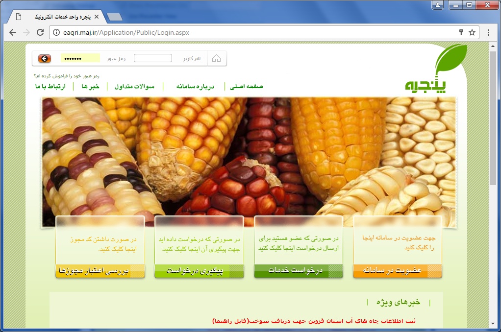
The Integrated Agricultural Licensing System (Single Window Portal) eagri.maj.ir
Objectives and Functionality:
In order to facilitate agricultural investment and employment, the system of issuing licenses designed and implemented with the below objectives:
ü Optimizing the processes of providing services
ü Agility and reducing the time and cost of providing services
ü Increasing productivity in better providing services than before
ü Clarifying the processes and confronting corruption
ü The ability to apply centralized rules, regulations and policies relevant to licenses
ü Access to statistics and information, on time
ü Creating the possibility to receive services of agricultural sector activists without attending
The system connected to various systems of related to licensing and authorization by web services and provides over 70 types of licensing services in the areas of animal production, herbal products, herbal medicine, rangeland, agricultural processing and complementary industries and so on.
The system has been launched since mid-2016.
Stakeholders:
v Agricultural activists(public or private)
v Organizations related to agricultural sector activities
v researchers
(eagri.maj.ir)
Objectives:
The Financial Facilities Management System has been launched to manage funds and requests for the use of facilities from various credit resources by applicants for investment in agricultural projects, related businesses, and the agricultural processing and complementary industries, including entrepreneurs, micro and macro investors, or the sector employees.
In this system all proposed projects related to the agricultural sector are examined and managed from the application phase to the phase of introduction into the operating banks with integrated system architecture.
This system has implemented pilot since 2015 in the three provinces of Iran, and then in early 2016 has launched in all of the country.
System features:
ü The possibility of registering and following the application by the applicant through the Internet website and notify the progression and result to the applicant through the website.
ü Monitoring and tracking activities at different levels of use.
ü Ability to apply rules, guidelines, circulars, terms and other documents governing the provided facilities, in the system.
ü Availability of reports required by executive and supervisory agencies and relevant organizations to monitor the status of credits and facilities and an accurate assessment of facilities performance.
Stakeholders:
v Operating banks
v Ministry of Economic Affairs and Finance
v Applicants to use financial facilities
v All related organizations at the Ministry of Agriculture
v Related managers and experts
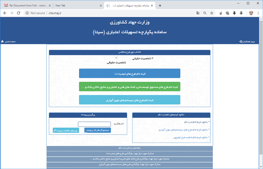
Figure 1 cita.maj.ir
Spatial Information System agrimap.maj.ir
The comprehensive system of zoning and management of agricultural data, with the aim of recording the information at its production site at the lowest possible level and providing the on-line statistics of the crop production situation (cultivation, gardens, livestock and poultry, Fisheries and related transformation and complementary industries) for use in agricultural production and trade planning, the guaranteed purchase of a of some products, the creation of the possibility of cash or non-cash subsidies for products requiring support in the agricultural sector,… has been created. The process of work is such, all the villages of the country are divided into separate zones and any expert will be responsible for one of the zones. Experts have the task of directing, educating, encouraging and guiding the holders to record information in this system. It should be noted that the stage of empowering the holders to record information in the system, data recording by these experts take place. The recorded information was reviewed by the head of the Agricultural Jahad Center, and, if necessary, reviewed and revised by the expert responsible for the zone again. Upon confirmation, the information will be available and usable in the system at the all level of the Ministry of Agricultural Jahad.
In this system, in addition to recording the holders and its holding specifications, there is the capability to record holder’s activity during the time. As well as another data such as, Types of crops
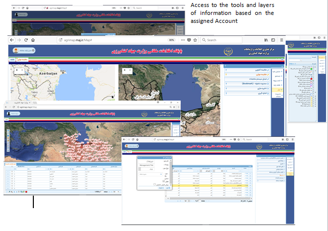
Viewing different satellite images, photos and layers in two windows for comparing same position.